
GIS

Xiamen Version of Map World to be Launched This Year
China’s State Bureau of Surveying and Mapping has launched an official online map service called Map World in 2011. It allows users to explore and search for specific locations, and

Supergeo Establish User Network with Evolving Geosystems in UAE
Supergeo Technologies, a leading global provider of GIS software and solutions, announces the official reseller agreement with Evolving Geosystems Technologies (EGT) to keep providing high-quality total SuperGIS solutions in UAE.

Election Commission of Pakistan to Use GIS
In recent news by The Express Tribune, The Election Commission of Pakistan (ECP) has come up with an ambitious and strategic plan for the next five years. The plan (Second
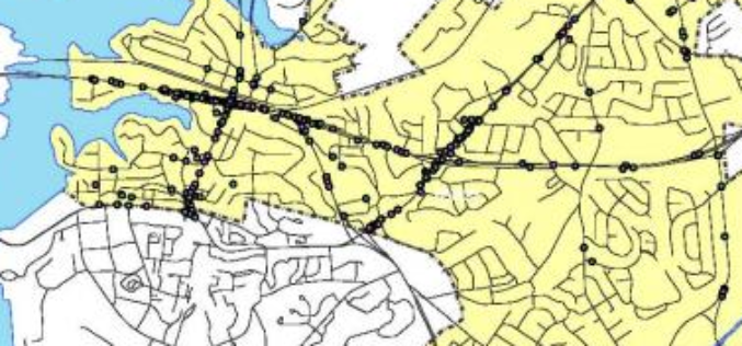
Mapping Accidents Spots Across Bangalore
In recent news, the Indian Institute of Science in association with Bangalore Traffic Police has come up with mapping of accident spots in Bangalore city. The project “Mapping of all

SuperGIS Desktop Assists Geo-Sol, South Africa, in Efficient GIS Processing
Supergeo Technologies, a leading global provider of GIS software and solutions, announces that Geo-Sol, South Africa chooses SuperGIS Desktop 3.2 for high-efficiency GIS data processing and spatial analyses for earth
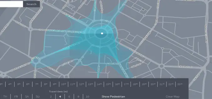
Isoscope a New Way to Explore and Visualize Mobility
We have been using Google Maps to find out the directions, distance and even real time navigation with estimated travel time according to traffic situations. But a team of developer in

DOST-UP’s Plane to Fly in ARMM to Chart Hazard Map
Manila, April 29 — The Department of Science and Technology (DOST) will fly a plane over the Autonomous Region of Muslim Mindanao in August to survey the region for hazard preparedness. The

The OGC® adopts OGC Geo and Time Extensions Standard for OpenSearch
The Open Geospatial Consortium (OGC®) Members approved “OGC OpenSearch Geo and Time Extensions” as an OGC standard. This document defines an extension to the popular OpenSearch specification so that users
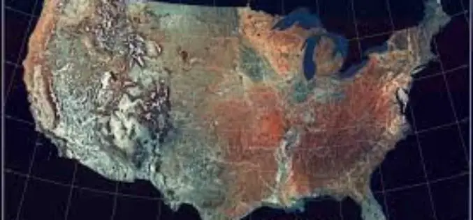
Revised West Virginia, New Jersey and Georgia Maps Feature New Design
Newly designed US Topo maps covering West Virginia, New Jersey and Georgia are now available online for free download US Topo maps now have a crisper, cleaner design – enhancing readability
Esri Opens Its Storytelling with Maps Contest
Redlands, California—April 22, 2014- Anyone who has ever created a story map, or wanted to, is invited to enter Esri’s Storytelling with Maps Contest. “Everything is fair game, including Story Maps you’ve
