According to recent news by BTvIn, Indian Prime Minister Narendra Modi has signed off a “Blue Revolution” with the approval of Rs 3,000 crore for the Integrated Development and Management of Fisheries scheme for a period of five years.
The Central Government Sector scheme will cover development and management of inland fisheries, aquaculture, and marine fisheries including deep sea fishing, marine culture and all activities undertaken by the National Fisheries Development Board (NFDB) towards realising the “Blue Revolution”.
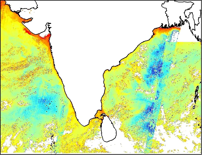
Potential Fishing Zone in Bay of Bengal, Arab Sea and Indian Ocean
The scheme will also cover the activities of National Fisheries Development Board (NFDB), development and strengthen database and geographical information system (GIS) of the fisheries sector among other aspects.
“The scheme provides for suitable linkages and convergence with the Sagarmala Project of the Ministry of Shipping, Mahatma Gandhi National Rural Employment Guarantee Scheme (MGNAREGA), Rashtriya Krishi Vikas Yojana (RKVY), National Rural Livelihoods Mission (NRLM),” an official release said.
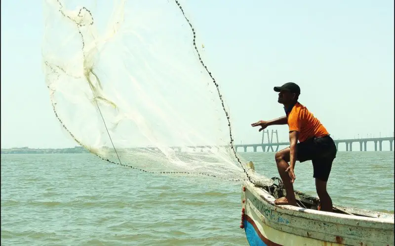
The scheme would benefit the entire fisheries sector covering about 14.50 million fishers and will also encourage increasing private investment, entrepreneurship development, more Public Private Partnership (PPP) and better leveraging of institutional finance.
The Indian National Centre for Ocean Information Services (INCOIS) has given its vital contribution fisheries sector. The Tuna Fishery Advisory and Potential Fishing Zone Advisory are two important advisory solution to guide fisher men.
Tuna fishery advisories have been operationalised from November 2010 onwards ESSO-INCOIS has streamlined the operational generation of Tuna fishery advisories using the satellite derived parameters viz. Sea Surface Temperature, Chlorophyll and Kd490 (Water Clarity). The advisories are being sent to the tuna long liners through the website (WebGIS) and emails.
The concerted collaborative efforts of scientists from Earth Sciences, space and fishery science have resulted in successful demonstration of the application of satellite derived data for the demarcation of ‘Potential Fishing Zone (PFZ)’ as a proxy to ‘potential shoals of fish aggregation’ in the Indian waters
Utilizing the remotely sensed data available from various satellites, ESSO-Indian National Centre for Ocean Information Services (INCOIS), provides these advisories to the fishermen on a daily basis with specific references to 586 fish landing centers along the Indian coast. This operational service is rendered by ESSO-INCOIS throughout the year except during the periods of Marine Fishing ban imposed by Government of India and adverse sea state conditions such as Cyclones, High Waves, Tsunamis, etc.