
Ohio University Online
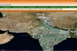
The Federal Aviation Administration predicts that by 2017, the market for military UAVs will surpass $10 billion, while the Association for Unmanned Vehicle Systems International believes that private drone sales will break $82 billion in the first decade of sales. There’s no question the UAV industry is booming, but that growing popularity brings a multitude of benefits and challenges.
To learn more, check out the infographic above created by Ohio University’s Online Master of Science in Electrical Engineering
UAV or unmanned aerial vehicle is a remote-controlled aircraft. It can be operated remotely in real time or pre-programmed to fly autonomously on the pre-defined routes. Popularly known as drone, the use of this type of aircraft is increasing in all sectors. It is important to note that missiles that fly autonomously are not categorized as UAV. These attack units are classified separately under the weapons category. UAVs or drones can be classified in different ways.
Classification of UAVs
- Classification of Drones by Size
1. Large Size Drones
These drones are used in the attack, combat and reconnaissance roles. Large size UAVs can fly to a very long distance without recharging or refueling. Large attack systems can carry missiles that can be fired remotely after observing and locking in the target. Reconnaissance UAVs are used to observe and secure a very large area.
2. Medium Size Drones
This range of drones is generally used in reconnaissance or to gather data. Such units are deployed in military, commercial, industrial and agricultural fields.
3. Small Size Drones
These drones are the most widely used units. UAVs of this size are used by commercial establishments, government departments, professional photographers and hobbyists.
4. Miniature Drones
These units are used for very specific purpose. Miniature drones have been developed for military usage. The device is small enough to fit in the palm. Military personnel use it for spying during a close combat mission. It can be used to view the inside of a standing or damaged building during search and rescue operations.
- Classification by Design
1. Aircraft Design
This type of UAV has propeller on the tail or nose. Some wing design units have propellers on the wings. Jet propulsion is also used in large UAVs. There are small units that can be launched even from hand but larger units require a small runway to get off the ground. The advantage of this design is that this type of UAV consumes lower amount of energy compared to UAV with tilt rotor design.
2. Tilt Rotor Design
This type of UAV is also called quadcopter because of use of four rotors for lift and propulsion. It can lift off and land anywhere in the same way as a helicopter. These UAVs are the most widely used units due to ease of launching and landing. There is no need of runway or catapult to launch the aircraft.
- Classification by Usage
1. Military
UAVs have been used widely in attack and combat roles. Military use of drones includes reconnaissance and observation from the sky. Cargo drones are used to supply weapons and cargo to the military units.
2. Commercial
There are a wide range of commercial applications of drones. A camera equipped drone is used to map an area. It helps know if the proposed construction site is suitable for construction of a particular structure. UAV is used in commercial sector to take photos and videos of buildings, construction sites and ground areas. Real estate developers use such photos and videos to advertise their building projects.
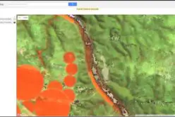
3. Agricultural
Farmers use drones to spray pesticides, fertilizers and other chemicals. Special camera and sensors are used to spot problems in the crops. Diseased parts of the crop can be spotted early. Different types of data related to the farm, crop, land and atmospheric conditions can be collected. This data is used to ensure healthy crop and successful harvest.
4. Police
Law enforcement agencies use drones to fight crimes. They use it for surveillance of a suspected target. Real time surveillance is useful during active crime scenes where sending the police personnel without knowing the ground situation can be dangerous.
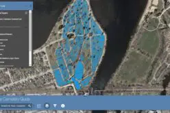
5. 3D Mapping
Advance 3D imaging equipment installed in a drone is used to survey landscape. Thousands of high quality images are stitched together to create precise and high definition 3D map of a ground area. It gives a better understanding of the geographical features of the area.
6.Disaster Relief
It is difficult to know the magnitude of destruction immediately after a disaster. There is urgent need to find the ground information quickly. Sending search and rescue teams to such an area without prior knowledge of ground conditions may result in waste of precious time. A UAV helps know exact locations where help is needed.
7. Hunting Hurricane
Drones equipped with scientific equipment are used to observe storms and other natural disasters. The data collected and analyzed from such operations are used to develop predictive models that help predict an impending disaster with better accuracy.
8. Product Delivery
This type of commercial venture is yet to take off due to regulatory constraints. However, many companies are working actively in this field. It is going to be a lucrative field for the sellers of products.
9. Research and Development
Scientists use drones to gather different types of data related to the ground, sea and air. They can find useful data without sending several teams to the target locations. Accurate scientific data from various locations can be collected quickly and easily.
10. Reconnaissance
UAVs are now used widely to protect border areas from intruders. It helps gather intelligence information in the battlefield. The information proves useful in protecting borders, combat units and security installations. Military personnel can avoid high risk missions or go to such missions with better information of the ground situation
11. General Users
Hobbyists use small size drones for recreational purposes. These units are used to enjoy the thrill of flying an aircraft. Now many UAVs made for general users have camera to take photos and videos. Some new UAV models can follow the moving drone pilot. There are strict drone flying rules and regulations that hobbyist drone operators must know.
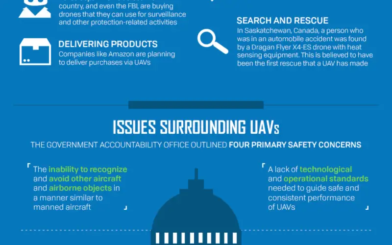
There are various problems, issues and challenges associated with UAVs. It is difficult to regulate flying of small drones. Thousands of small drones are sold every year. These products are available easily online and offline. A small drone can be built even by a novice using easily available parts from the Internet. Even a small drone poses high safety risks to large planes and ground installations like fuel depots. There are occasional instances where operators lose control of their UAV during the flight. There have been no serious accidents so far but there are many reports of criminals using drones to supply illegal and banned items into prisons. The insurance aspect is not fully defined and developed. There are privacy risks to people. Drones can fly high and record visible parts of a private property. It can be used to look inside homes through windows.
Government authorities have been trying to overcome these challenges with proper regulations. There are many rules and regulations for UAV ownership and operations and law enforcement agencies are already using different technologies to stop rogue UAVs. The options include signal jamming as well as capturing and attacking to bring down the rogue UAVs.
The drone industry is also advancing at a rapid pace. Large numbers of UAVs are being sold and used all around the world, and the market for military drones is expected to exceed $10 billion by 2017. Private UAV sales are expected to cross $82 billion in the first 10 years. At the same time, the drone industry is expected to generate more than 100,000 jobs. Use of such technologies help improve living conditions. There are benefits and challenges in use of UAVs. Governments are trying to keep pace with these developments by framing proper rules and regulations.