
Posts From GIS Resources

SI Imaging Services Announces “Bulk Order Contract” with URSA
The SI Imaging Services has signed a “Bulk Order Contract” with a geospatial data and analytics company URSA Space Systems Inc. The SI Imaging Services a leading provider of VHR
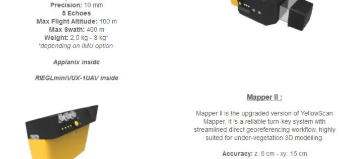
YellowScan Unveils Its Next Generation UAV-LiDAR Systems
Montpellier, 21 September 2017 – YellowScan is committed to provide the most reliable integrated imaging systems and customer support for demanding UAV applications. Since 2012, the team’s dedication to fulfill high resolution and high-quality survey

DLR-JAXA Joint Statement Concerning the Bilateral Cooperation
September 20, 2017 – Japan Aerospace Exploration Agency (JAXA) and the German Aerospace Center (Deutsches Zentrum für Luft- und Raumfahrt; DLR) held the Inter-Agency Meeting to strengthen and deepen the

Several Improvements Made in the Latest Version of SuperGIS Desktop 10
Developed by Supergeo, one of the world’s leading brands of GIS software, SuperGIS Desktop is a multifunctional product designed for desktop computers. It enables users to accomplish diverse tasks, including
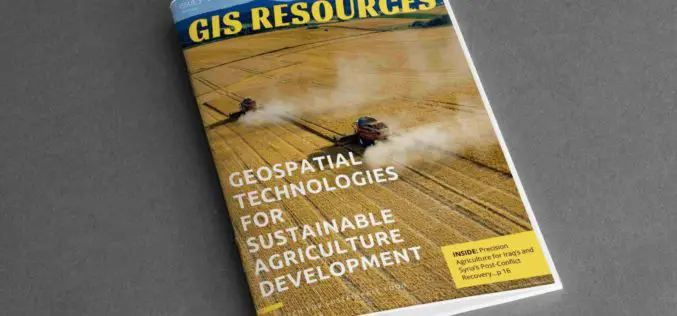
3rd Edition of GIS Resources Magazine: Geospatial Technologies for Sustainable Agriculture Development
GIS Resources Magazine (3rd Edition): Geospatial Technologies for Sustainable Agriculture Development Thanks for your interest and downloading GIS Resources Magazine – 3rd edition. Click to Download Thrid Edition – Geospatial Technologies
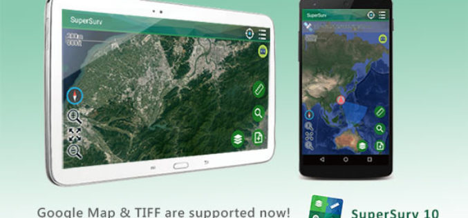
SuperSurv 10.1 Supports New Raster Formats and Online Maps
As the information technology constantly evolves, the geospatial industry also grows fast. Currently, including many open source projects, numerous services are providing online maps to geospatial professionals. As professional and
3D Stereo, Point Clouds, UAS, Virtual Reality and City Solar Solutions on Exhibit at INTERGEO
Anchorage, Alaska, USA. September 18, 2017 – Join DAT/EM Systems International® with co-exhibitors DAT/EM Systems Europe and RhinoTerrain™ SARL at INTERGEO from September 26-28 in Berlin, Germany. Booth visitors (C2.026 in Hall

FAA Works with Florida Drone Operators to Speed Hurricane Recovery
September 15–After the widespread devastation Hurricane Irma wreaked on Florida last weekend, unmanned aircraft – more popularly, drones – have been invaluable in supporting response and recovery efforts in the

Introducing Trimble Clarity – A Cloud-based Geospatial Data Viewer and Collaboration Product
Introducing Trimble Clarity – A Cloud-based Geospatial Data Viewer and Collaboration Product September 27, 2017 Join us live from the Intergeo Geospatial Conference in Berlin, Germany as we present Trimble

Skyfront Sets World Record for Drones with 4 Hour and 34 Minute Flight
Skyfront invents hybrid-electric drone technologies to enable monitoring of large, remote assets in challenging terrain for the Utility, Agriculture and Energy industries. MENLO PARK, CA, SEPT. 12, 2017 – Skyfront,
