Disputing ownership of real estate often occurs in a country with long history. Before the modernization, people usually just roughly point out their properties by obvious and immovable landscapes, such as rivers, hills or artificial structures. Since landscapes often change, people used to argue or fight for a correct boundary of their immovable properties. An accurate measurement and management on land data is often considered as a feature of a modern country.
Founded in 1924, General Directorate of Land Registry and Cadastre was established as an independent authority of land registry and surveying in Turkey. This department has been responsible for management and maintenance of land data nationwide. With advancement in modern technologies, the land registry agency in Turkey was switched to digital data instead of traditional paper works several years ago, which has allowed authorized users to download and query data more easily.
Challenges
Since land data is stored digitally, field workers of this Turkish land agency must also survey the modifications or registrations of land with digital data. But the workflow was complicated and offline that many processes had to be accomplished, which included downloading related data to the computer, extracting files into Hi-Target V60 GNSS-RTK, surveying the new data and transferring again to the computer for uploading.
Due to fast development, the land data in Turkey changes rapidly. As a result, the field workers of land agency encountered an important problem that they often use outdated data while they are surveying.
And another problem is that heavy and fully functional computers were required for geospatial data processing, which is very inconvenient for working in field.
Goals
For solving the problems mentioned previously, two goals should be attained:
- A more integrated workflow should be proposed and conducted that could avoid redundancy in time and resources.
- The field work should be done without carrying heavy and fully functional equipments to the field.
Solutions
By a close cooperation between Supergeo R&D team and Zenith GIS (Supergeo’s reseller in Turkey), several innovated features were added to SuperPad. The field workers have installed and operated SuperPad on their Dell Venue Pro tablet computers with Windows OS.
- On-the-fly Projection:
SuperPad can help users to integrate geospatial data with different coordinate system in a single project and also allows users to create or modify the parameters of projection and bring better precision and flexibility to the field work.
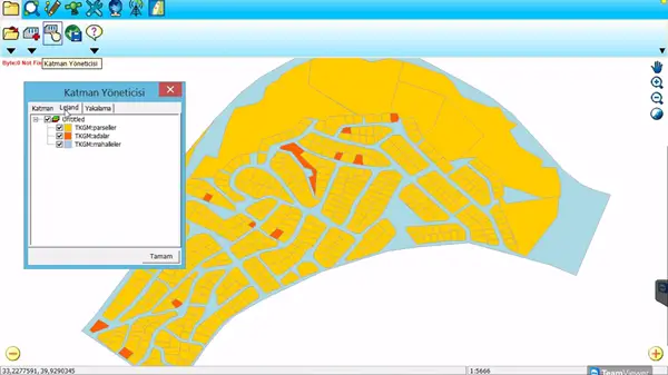
Fig1. Overlapping different layers in a single project
- WFS Support:
WFS service is accessible after entering the authorizing information on SuperPad. Any vertices from WFS features can be saved as waypoints. Users can easily navigate or mark up these waypoints and apply in the stakeout process.
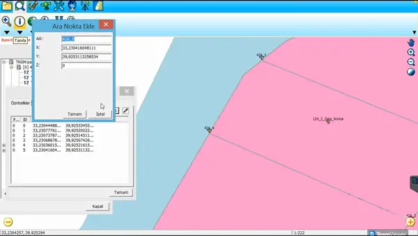
Fig.2 Saving the vertices from WFS
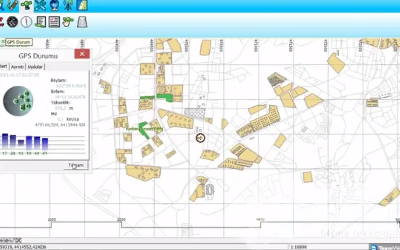
- Visualize Standard Deviations of Errors:
The standard deviations of both horizontal/vertical coordinates are visualized while GNSS is activated. For the field workers, it is important to know the range of possible errors when collecting data with survey devices.
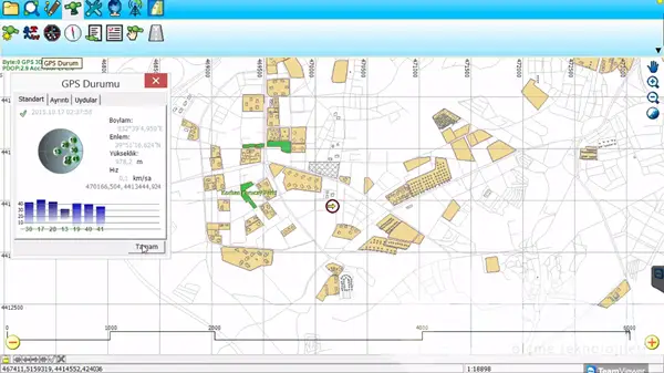
Fig.3 Receiving data from GPS
Results
By integrating the hardware and SuperPad properly, the workflow has been largely improved, and the time has been saved. Field workers of land agency can now use this all-in-one solution to access various web map services and edit the files without complicated data processing and transferring procedures.
Benefits
The combination of SuperPad and the hardware could deliver a powerful solution for land surveying or other field works. Various web map services can be instantly received, which includes WMS, WFS and WMTS. Point features published by WFS could be navigated directly. And because of on-the-fly projection, differences between data from different time could be clearly compared. All these features provide great advantages for field workers to execute tasks more properly and efficiently. Advanced technologies on Mobile GIS Solution, High-Precision GNSS and Smart Device have strongly supported and helped field workers of Turkish land agency to survey buildings and lands in a smart and efficient way.