Agriculture Ministry Plans to Utilize Remote Sensing to Map Potato & Onion Cultivation Area
NEW DELHI: According to recent news by The Economic Times, the agriculture ministry is planning to use remote sensing technology to map the area under potato and onion cultivation for the entire country to provide an accurate estimate of the likely production of the respective crops. This would be extended to cover orchards in the next phase.
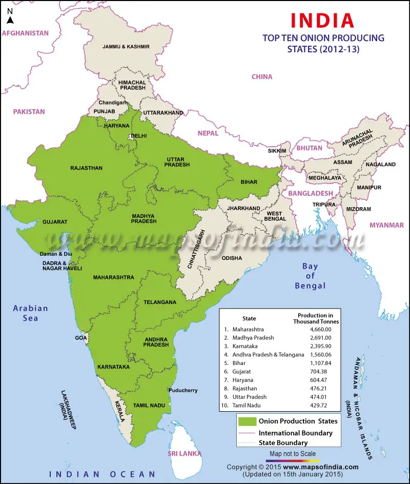
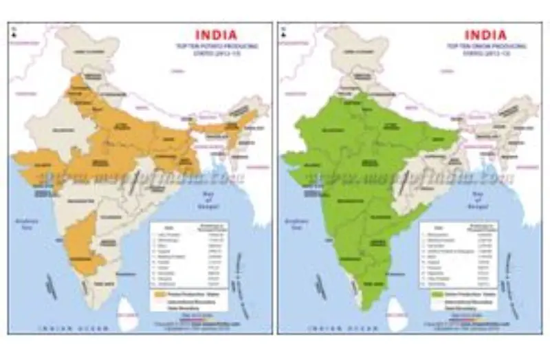
Top Ten Onion Producing States in India
Credit: Maps of India
The department was working on uploading maps of fruit crops (from oranges to mango) onto the Bhuvan platform — a software application browser which explores 2D/3D representation of topography. Currently, details of mango orchards are being worked out in three major districts of Karnataka and other states and their database creation is being done on Bhuvan, the official said. Maps on areas under mango cultivation maps have already been finalised in the major mango producing districts of of Bihar and Uttar Pradesh.
The ministry is also working on developing a methodology for precision farming and assessment of major vegetable
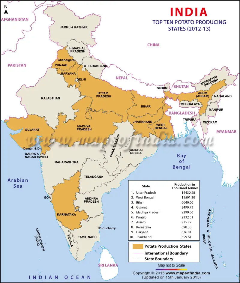
Top Ten Potato Producing States in India
Credit: Maps of India
crops under a project called ‘Coordinated Horticulture Assessment and Management using Geo-Informatics’ (Chaman). Launched in September 2014, the project is targeted to be completed in three years at an estimated cost of Rs 13.38 crore, the agriculture ministry stated. The programme aims to develop a methodology to estimate the area under horticulture crops and its likely production using remote sensing technology and sample survey methodology.
The methodology for estimation of areas under other crops like tomato, chilli, mango, banana and citrus has also been developed, the ministry stated.
The Indian Agricultural Statistics Research Institute is reviewing the progress of the data collected on the area and production of horticulture crops in Maharashtra, Tamil Nadu, Andhra Pradesh, Himachal Pradesh, Madhya Pradesh and Haryana. The final report will be submitted by August 2017, said officials at the institute. Field work to estimate area and production using sample survey methodology will begin in Karnataka in 2016-17 (agriculture year July 1, 2016 to 30 June, 2017), they said.