
Archive
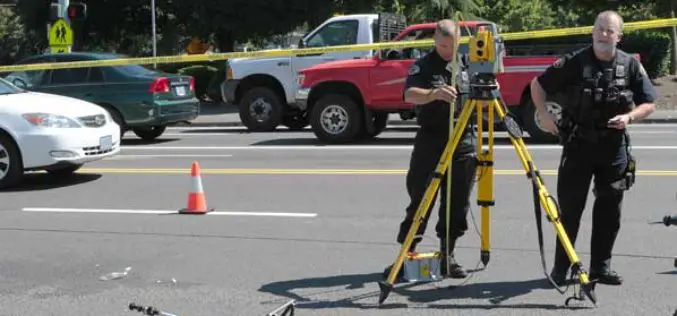
Geospatial Technology in Forensic investigation
Surveying provided the basis for man to know ‘what is where’ and ‘when’. The technology, if we can call it a technology during the early 19th century, was
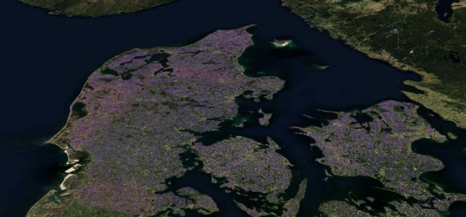
Machine Learning Helps SEGES to Detect 26K Slurry Tanks over Denmark to Assess Ammonia Emission
The article talks about How SEGES detected 26000 slurry tanks over Denmark in a few hours using Picterra to assess ammonia emission.
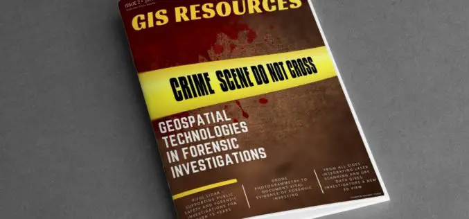
GIS Resources Magazine (Issue 2 | June 2020): Geospatial Technologies in Forensic Investigations
GIS Resources is pleased to announce the release of its 2nd edition (June 2020) of the print and digital magazine. The edition titled “Geospatial Technologies in Forensic Investigations” focuses on the
Get More from Imagery Using 30 New Features Released to Geomatica Banff
PCI Geomatics has announced the release of over 30 new features and enhancements to photogrammetry and remote sensing solution, Geomatica Banff.
Join MAXAR to Learn How Satellite Data is used by Organizations in Responding to Business Disruption and Emerging from Lockdown
Join MAXAR to Learn How Satellite Data is used by Organizations in Responding to Business Disruption and Emerging from Lockdown
