
Archive
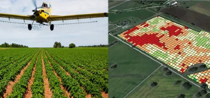
Unleash Agri-Production With Geospatial Technology
Contributed By:- “Food security exists when all people, at all times, have physical, social and economic access to sufficient, safe and nutritious food that meets their dietary needs and food
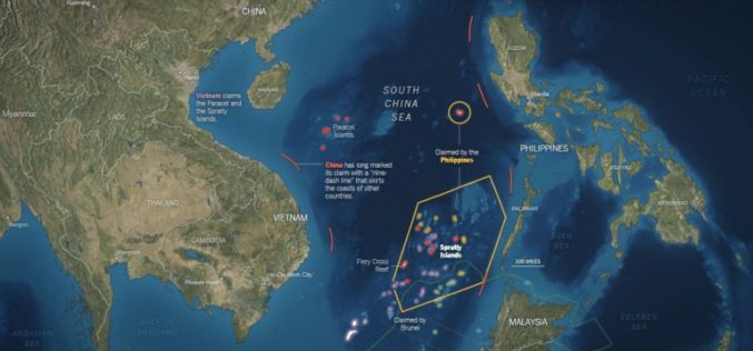
Old Map Denies the Philippines’ Claim Over South China Sea
NEW YORK – An old map published in 1899 by geographer J. Martin Miller shows that islands in the South China Sea have never been Philippine territory, Zeng Yingjing, the
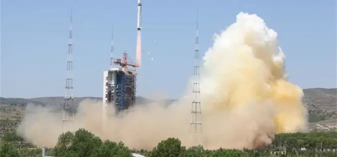
China Launches New High-resolution Satellite for Civilian Mapping
IANS – China on Monday launched a new civilian high-resolution mapping satellite from the Taiyuan Satellite Launch Centre in Shanxi province. The 2.7-tonne Ziyuan III 02 satellite soared on the back
Galileo and EGNOS Benefitting the Geospatial World
Speaking at this week’s Geospatial World Forum in Rotterdam, the European GNSS Agency (GSA) discussed the many benefits that EGNOS and Galileo offer the geospatial sector and, specifically, the surveying
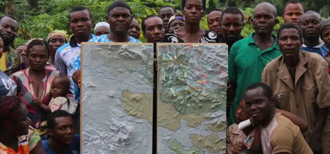
Cameroon’s First Participatory 3D Mapping for Forest Monitoring and Conservation Management
A three-dimensional model of part of the Cameroon Highlands will be unveiled on Monday 30 May in an official ceremony at the Southwest Regional Delegation of Forestry and Wildlife (MINFOF).

Esri India Webinar: What’s new in ArcGIS 10.4 Desktop?
Esri India Webinar: What’s new in ArcGIS 10.4 Desktop? 2nd June 2016, 11:00 AM IST onwards ArcGIS 10.4, the latest release, includes exciting new capabilities for visualizing and analyzing data.

Royal Society Funded PhD Studentship: Remote Sensing to Assess and Monitor Funding Conditions
Swansea University is a research-led university that has been making a difference since 1920. The University community thrives on exploration and discovery, and offers the right balance of excellent teaching
Coming Up Next: SuperGIS Server 3.3
The new GIS server from Supergeo, SuperGIS Server 3.3, is a product designed to meet the modern technologies in client side applications. One of the major upgrades will focused on
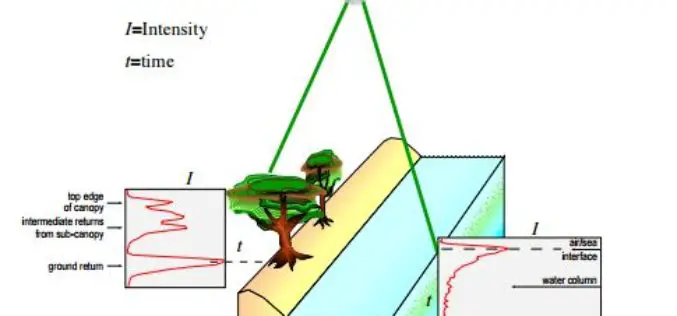
Algorithms used in the Airborne Lidar Processing System (ALPS)
The Airborne Lidar Processing System (ALPS) analyzes Experimental Advanced Airborne Research Lidar (EAARL) data—digitized laser-return waveforms, position, and attitude data—to drive point clouds of target surfaces. A full-waveform airborne lidar
CartoDB Webinar: Deep Insights – Transform Your Data Into Actionable Insights
Deep Insights – Transform Your Data Into Actionable Insights Recorded | Duration 45 Minutes Did you miss our last Deep Insights webinar? CartoDB’s Sales Director, Jaime de Mora, gave a
