• Peru’s first satellite image reveals Cuajone, a large copper mine in the south of the country
Contributed By:

1975 A Love Story
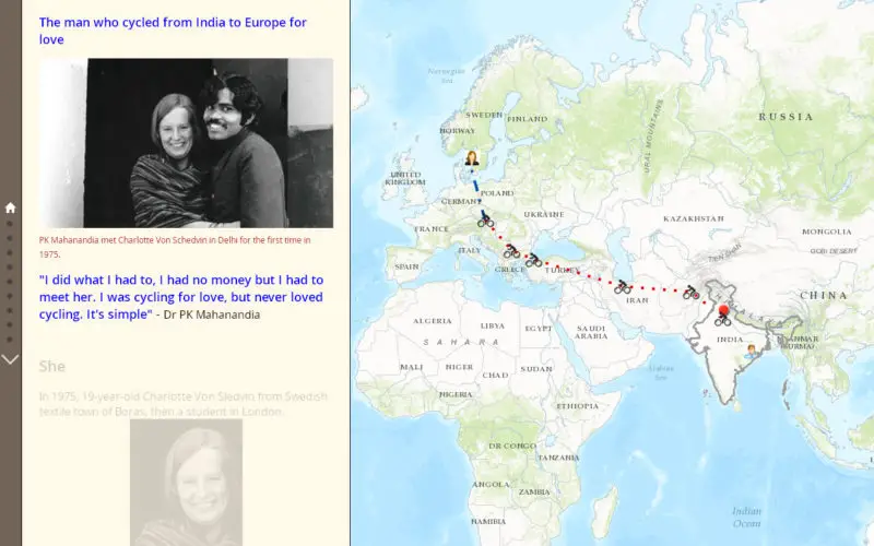
The man who cycled from India to Europe for love.
“I did what I had to, I had no money but I had to meet her. I was cycling for love, but never loved cycling. It’s simple” – Dr PK Mahanandia
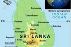
Mr. Abhishek Sindal has created Story Map using Esri mapping technology to share the love story of Dr PK Mahanandia, who cycled from India to Europe for love “Charlotte Von Schedvin”. Dr. PK Mahanandia met Charlotte Von Schedvin in Delhi for the first time in 1975.
Dr. P.K. Mahanandia was born on 1949 in an Odia weaver family, in Kandhapada village of Athmallik Sub-division in the district of Dhenkanal, Odisha, India. Dr. P.K. Mahanandia is an artist by profession and first time met Charlotte Von Schedvin on a winter evening in Delhi in 1975 when she asked him to draw her portrait. Ms Von Schedvin was visiting India as a tourist when she spotted Mr Mahanandia in Delhi’s Connaught Place.

And there started their journey and passes through the phase of marriage. Charlotte said goodbye to him to start her return journey, but made him promise that he would follow her to her home in the Swedish textile town of Boras. No doubt the two kept in touch through letters.
Mr Mahanandia however, did not have enough money to buy a plane ticket. Determined to pay his own way, two years later, PK sold all his possessions, bought a second-hand bike, and set out on an epic journey that would cover eight countries and take almost five months. He followed her along the same hippie trail. His journey started on 22-Jan-1977 and he would cycle for around 70km (44 miles) every day.
Click to visit Story Map 1975 A Love Story
Source for Content: Esri Story Map – 1975 A Love Story